What was once the greatest pride of Central Asia is now the worst environmental disaster of the modern era. The Aral Sea was the fourth-largest lake in the world, behind the Caspian Sea, Lake Superior, and Lake Victoria. Its vast area of 68,000 sq km included parts of Uzbekistan, Tajikistan, Kyrgyzstan, Kazakhstan, Turkmenistan, Iran, and Afghanistan.
It supported fish, zooplankton, 250 species of invertebrates, birds, antelopes, and several human communities that lived off a booming fishing industry. The Aral Sea was a saline lake nicknamed the “sea of islands” by locals, because its shallow waters, just about 50m deep, supported over 1,000 islands.
The sea was formed between 23 and 2.5 million years ago and filled with water by the Amu and Syr Darya Rivers, its only two feeder rivers. The surrounding climate was dry and desert-like. Still, as long as those two waterways — themselves nurtured by snowmelt from the Tien Shan and Pamir Mountains — replenished it, it could hold its own.
At the turn of the 1960s, the sea began to suffer at the hands of Soviet irrigation projects. The decline eventually led to its desertification.

Satellite image of the Aral Sea. Photo: Kitnha/Shutterstock
Where it went wrong
In 1918, the Bolshevik government set its eye on Central Asia for its potential to grow cotton or “white gold”, along with other crops like melons. These are very thirsty crops — not a great thing to grow in a desert. But in the late 1940s, Stalin followed through on the Bolshevik’s original idea. He called it “The Great Plan for the Transformation of Nature”.
He envisioned large-scale hydro-engineering, land development, and irrigation projects to improve agriculture. The plan was to divert the waters of the Amu and Syr Rivers to feed the crops. These irrigation canals temporarily succeeded. But wholesale tapping of those two rivers deprived the Aral Sea of its life’s blood.

The dry seabed of the Aral Sea. Photo: Vladimir Konstantinov/Shutterstock
The low-volume, large-area lake began to evaporate quickly under the baking sun. According to researcher Rama Sampath Kumar, “Upstream irrigation schemes consumed, like a sponge, more than 90% of the natural flow from these rivers.”
In addition, rampant use of pesticides and fertilizer ran off into the sea. The evaporation increased the water’s salinity levels. This toxic soup killed off most of the aquatic species and created deadly health problems for the local populations. This included lung disease, tuberculosis, kidney disease, high child mortality, and cancer. It also poisoned the livestock. It became a graveyard of former fishing vessels.

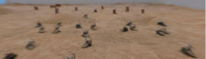
One of many rusted hulks that now lie over 100km from what used to be the Aral Sea. Photo: Jerry Kobalenko
Anthrax Island
To make matters worse, the Soviets turned the largest island, Vozrozhdeniya, into a bio-weapons testing area, which was not always secure. The laboratory on the island was abandoned in the 1990s, with the fall of the USSR, but by then it was too late.
Before the Soviet projects began, the Aral Sea contained 55 billion cubic metres of water. By the 1980s, it decreased to 7 billion. By 2010, the surface area measured just 14,280 sq km.
Within a span of 30 years, from the 1960s to the 1990s, the lake’s volume decreased by 80%. Its salinity soared to 376g per litre. In 2014, the eastern basin became known as the Aralkum Desert, completely devoid of water. The once-great treasure of Central Asia had become a pesticide-laced fraction of its former grandeur.
Attempts at recovery
The construction of the 12km-long Kokaral Dam split the remnants of the Aral Sea into the North and South Aral Seas. This seemed to have a positive impact on at least the northern section. Conservationists noticed a rise in water levels from 30m in 2003 (before the dam’s construction) to 42m in 2008. Salinity has decreased by 50%, and 24 species of fish are now able to survive in the rising waters. The dust bowls were significantly reduced. A program to plant saxaul, a hardy desert shrub, to stabilize the soil is underway. The water has reportedly crept 75km closer to the city of Aralsk.
However, by 2020, the dam’s low height proved insufficient. The water has reached the top and levels cannot go any higher. As for the South Aral Sea, it has not had any luck. It may become a site for oil drilling. Many government and environmental bodies have put forth additional plans to resurrect the dead sea. We have yet to see the results.

Satellite image of the Aral Sea in the 1960s.