Cartographers at one of the most reputable mapping organizations in the world played a secret game for decades, hiding images in their work. Some pictures evaded detection till recently.

A 1980 drawing of a spider whose spindly legs lay atop an ice field was the first hidden illustration detected. Photo: My Modern Met
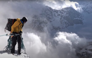
The Swiss Federal Office of Topography (Swisstopo) –- the unlikely source of these rogue works — is renowned worldwide for its rigorous proofreading and meticulous accuracy. Swisstopo is the industry benchmark for mapping mountain regions, thanks to their use of aerial photogrammetry and aerial perspective. Their reputation and precision earned them a 1988 commission to draw Mount Everest.
Yet behind the scenes, whimsical cartographers indulged in their secret game. The first Illustration discovered was a drawing of a white spider whose spindly legs loomed over an ice field on the North Face of the Eiger. Othmar Wyss drew the exquisite display of rogue cartography in 1980.

One cartographer carefully blended a fish into its natural habitat.
The next discovery was a fish northwest of the town of Interlaken, Switzerland. The author, cartographer Friedrich Siegfried, blended it subtly into its native environment, a French nature preserve. It probably honors an April 1 inauguration, which some European countries celebrate by attaching an “April Fish” to the backs of shirts. Later, in the 1990s, Siegfried sneaked in a climber ascending an Italian mountain within contour lines, his specialty.
The most recent find is a marmot hidden within the contour lines of the Swiss Alps. The artist blended it into a rock formation. The company, wise to the game by now, eventually identified Paul Ehrlich, who specialized in rock drawings, as the illustrator. He left the work as a parting gift shortly before his retirement in 2011.
Not amused
Needless to say, Swisstopo hasn’t commended its budding artists. “Creativity has no place on these maps,” said a spokesperson for Swisstopo. Cartographers at Swisstopo have a mandate, they added: “to reconstitute reality”.
Ehrlich confessed that he had thought of several places in which to hide a drawing. His aim was to leave reality undisturbed and to place the marmot in its natural environment.
A sketch of a naked reclining woman hidden in a map of a northern Swiss village was drawn in 1958 and uncovered almost 60 years later, in 2012. The marmot turned up five years later, in 2017.
When the company uncovers a rogue design, they remove it from circulation when updating the map. The fish lasted until 1989. The Italian climber remains in the current edition.

A hidden climber on an Italian mountainside.
The findings reveal an unusual streak of whimsy in cartographers. Their job strictly entails compiling analytical geographic data. Their mandate is to render the “real world” in precise detail, without errors.
Although the artists themselves have remained silent about their antics, the drawings likely occurred during the final stages of proofreading. The cartographers always positioned their illustrations far from cities, where fewer eyes saw them.
One current Swisstopo employee told Eye On Design magazine, “The proofreader is also just a human being prone to failure. And cartographers are also just human beings trying to fool around.”
No one knows the idea behind the game. Perhaps they hoped to leave a small, lasting legacy among the hard work that often goes unnoticed.
Trap Street
One charitable theory suggests that the illustrators left deliberate flaws as a copyright trap (known as Trap Street). The idea was to catch anyone who replicated the map unlawfully.
One particularly famous example of Trap Street was Edinburgh’s Oxygen Street. A cartographer purposefully placed the false street, which Apple Maps then unwittingly showed on their platform.
More likely, the cartographers were simply breaking the monotony of their meticulous daily routine. One cartography professor from ETH Zurich suggested that people in his profession tend to be “meticulous, really high-precision…[with] high levels of concentration”. It seems plausible that a little tomfoolery functions as a release valve for them.
Another theory is that the culprits were simply trying to have fun at the expense of their “highly accurate” colleagues at Swisstopo.
Switzerland’s cartographic history spans 175 years. Every 5 or 10 years, Swisstopo redraws its maps, incorporating the latest technology and changes. New train stations and airports appear, an old gunpowder factory disappears. Sometimes, a nude reclined woman or spider disappears forever.
A map named Bill
The Swiss aren’t the only ones to hide gems in the contours of their maps. Among the craggy lines of cliffs on the Isle of Wight, one cartographer etched a number of hidden names. Bill, Liz, Rob, Mike, and other names can be seen on publications of the Ordnance Survey Landranger map of The Solent & Isle of Wight, between 2006 and 2011. The names featured in a 2004 BBC TV documentary called Map Men, and in Mike Parker’s book Map Addict.
Accidental errors occur periodically on maps too. In the 17th century, California was depicted as an island. Seattle failed to appear on some maps from the 1960s. World maps often forget New Zealand.
While the cartographer’s tools have evolved since Anaximander first mapped the known world in the 16th century, technology can’t eliminate a harmless prank.
As yet, Swisstopo has not fired any employee for their part in the game.

During the Renaissance, cartographers transferred images using woodcut and copper-plate intaglio. Nowadays, their work employs geographic information systems, but pranks still make their way through even the best checks.